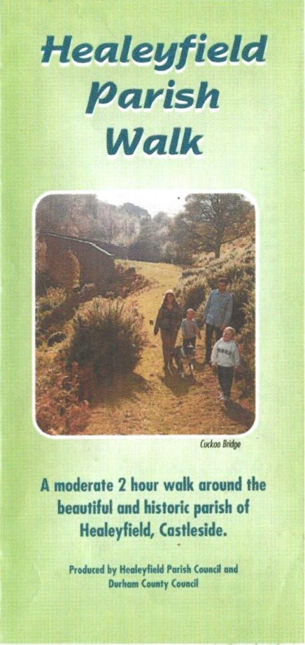
A moderate 2 hour walk around the beautiful and historic parish of Healeyfield, Castleside.
Enjoy the countryside and respect its life and work.
The Country ‘Ode’
Before you walk, may we point out to you,
This mini treck will take you through,
Land that is someone’s livelihood,
Meadows, streams, scrub and woods.
So show a little responsibility,
Close gates, use stiles, keep it litter free.
Take the paths, try not to stray,
And keep your dog well at bay.
For along this route you will agree,
Your countryside gives much to see.
But do remember before you start,
Wear proper shoes to avoid the clarts*.
*Clarts – Local expression for muddy/wet areas.

Starting Point:
The picnic site and car park on the Castleside to Stanhope road, quarter of a mile from the main Castleside A68 crossroad.
Refreshments:
Unfortunately the pub referred to in the leaflet above is no longer in business, nor is the Post Office or General Store. It is recommended to bring refreshments with you before starting the walk.
Public Transport:
Please refer to www.durham.gov.uk/busmap or your travel application for bus routes and times. At the time of publication the Go North East X5 & X15 are the main buses which visit Castleside.
Route Description:
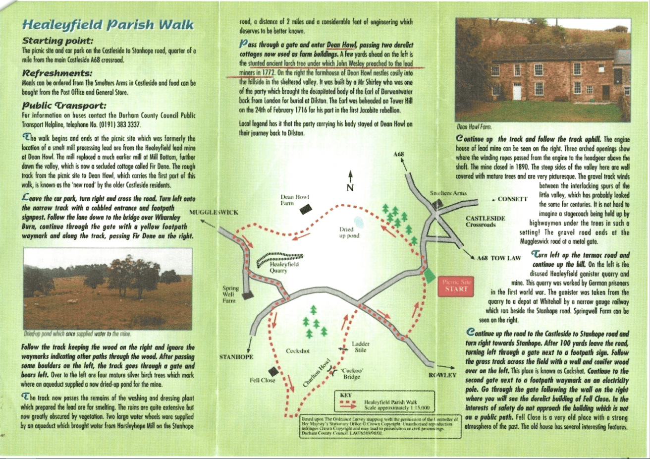
The walk begins and ends at the picnic site which was formerly the location of a smelt mill processing lead ore from the Healeyfield lead mine at Dean Howl. The mill replaced a much earlier mill at Mill Bottom, further down the valley, which is now a secluded cottage called Fir Dene. The rough track from the picnic site to Dean Howl, which carries the first part fo this walk, is known as the ‘new road’ by the older Castleisde residents.
Leave the car park, turn right and cross the road. Turn left onto the narrow track with a cobbled entrance and footpath signpost. Follw the lane down to the bridge over Wharnley Burn, continue through the gate with a yellow footpath waymark and along the track, passing Fir Dene on the right.
Follow the track keeping the wood on the right and igniore the waymarks indicating other paths through the wood. After passing some boulders on the left, the track goes through a gate and bears left.
Over to the left are four mature silver birch trees which mark where an aquaduct supplied a now dried-up pond for the mine.
The track now passes the remains of the washing and dressing plant which prepared teh lead ore for smelting. The ruins are quite extensive but now greatly obscured by vegetation. Two large water wheels were supplied by an aquaduct which brought water from Horsleyhope Mill on the Stanhope road, a distance of 2 miles and a considerable feat of engineering which deserves to be better known.
Pass through a gate and enter Dean Howl, passing two derelict cottages now used as farm buildings.
A few yards ahead on the left is the stunted ancient larch tree under which John Wesley preached to the lead miners in 1772. On the right the farmhouse of Dean Howl nestles cosily into the hillside in the sheltered valley. It was built by a Mr Shipley who was one of the party which brought the decapitated body of the Earl of Derwentwater back from London for burial at Dilston. The Earl was beheaded on Tower Hill on the 24th February 1716 for his part in the first Jacobite rebellion.
Local legend has it that the party carrying his body stayed at Dean Howl on the journey back to Dilston.
Continue up the track and follow the track uphill.
The engine house of lead mine can be seen on the right. Three arched openings show where teh winding ropes passed from the engine to the headgear above the shaft. The mine closed in 1890. The steep sides of the valley here are well covered with mature treees and are very picturesque. The gravel track winds between the interlocking spurs of the little valley, which has probably looked the same for centuries. It is not hard to imagine a stagecoach being held up by highwaymen under the trees in such a setting! The gravel road ends at the Muggleswick road at a metal gate.
Turn left up the tarmac road and continue up the hill.
On the left is the disused Healeyfield ganister quarry and mine. This quarry was worked by German prisoners in the first world war. The ganister was taken from the quarry to a depot at Whitehall by a narrow gauge railway which ran beside the Stanhope road. Springwell Farm can be seen on the right.
Continue up the road to the Castleside to Stanhope road and turn right towards Stanhope. After 100 yards leave the road, turning left through a gate next to a footpath sign. Follow the grass track across the field with a wall and conifer wood over the left.
This place is known as Cockshot.
Continue to the second gate next to a footpath waymark on an electricity pole. Go through the gate following the wall on the right where you will see the derelict building of Fell Close. In the interests of safety do not approach the building which is not on a public path.
Fell Close is a very old place with a strong atmosphere of the past. The old house has several interesting features,

It was originally roofed with ‘black thatch’, i.e. heather. There is also a studded oak door with a carved stone lintel. The nearby ruined enclosures and earthworks testify to the age of the place.
After Fell Close head straight across the rough ground for 200 yards to another gate next to an electricity pole. Go through the gate keeping the old hedge on the left. After 200 yards turn left through a gateway and cross the field to a gate in the wall opposite. This gate has two yellow waymarks indicating left and right. Turn left along the track.
This track is the secluded little valley of Charlton Howl, is the original route of the Stanhope and Tyne railway.
Follow the track until reaching the old ‘horse shoe’ arch bridge.
This bridge, which must be one of the oldest railway bridges in the worldm is known locally as the ‘Cuckoo Bridge’. Also in Charlton Howl (but hard to find) are three stones which mark the site of a shaft which was sunk to the southern most workings of the Healeyfield lead mine. The workings extended on as far north as the bank of the Derwent, emerging at the ‘Low Level’. The vein continues south to Burnhill and Saltersgate. As seen earlier the main shaft and winding engine were at Dean Howl. During the second world war a German bomber jettisoned its incendiary bonbs over Charlton Howl. Many did not explode and were collected by local people as souvenirs.
Leave the track at the old bridge and cross over a stile on the left under a sycamore tree, Walk up the hill on a well defined path taking time to look back at a lovely view of the old bridge in the valley, with the Durham moors in the background. Climb over the wall at the top of the hill using the old ladder stile and turn down the field to a kissing gate at the road. Turn right and continue along the road for approximately quarter of a mile. Turn left over a stile and follwo the footpath waymarks down the field and over two stiles before returning to the starting point at the picnic site.
